Tuesday, August 16, 2011

Kerala -cultural-historical and geographical State

0 comments
Kerala is a most popular state in South India. It was establish on 1st November 1956 by the States Reorganization Act, and it combined various Malayalam speaking regions. Spreading across an area of 38,863 km sq Kerala shares its borders with Karnataka in the north, Tamil Nadu in the south and the Lakshadweep in the west. Kerala also a state in Southern India is known as a tropical paradise of waving palms and wide sandy beaches. It is a narrow strip of coastal territory that slopes down the Western Ghats in a cascade of lush green vegetation, and reaches to the Arabian sea. Thiruvananthapuram is the captal of the state Kerala, it's also known as Gods Own Country Kerala is the favorite tourist spot of many Indian and foreign travelers.

There are 14 districts in Kerala. Based on certain cultural, historical and geographical similarities the districts of Kerala are grouped into; Malabar Region North Kerala), Kochi Region (South Kerala) and Travancore (Central).

Kerala become a favorite tourist place in India, over the years it is a popular tourist destination for its backwaters, yoga, Ayurveda treatments,coconuts, spices and art forms like Kathakali and Mohini Attam and tropical greenery natural beauty also touch our heart.

Kerala is the most literate state in India, and a land of diverse religions, where you can find Hindu temples, mosques, churches, and even synagogues.
Kochi is located on the western banks of the Arabian Sea and it is an important port city in Kerala. Travelling to Kerala by train is very easy. Kerala is connected to the other states and cities in India. Kerala Railway Network consists of almost 200 stations spread throughout the state. Kerala connects extremely well with major cities like Bangalore, Mumbai, Chennai, Kolkata, and Delhi and by 13 different railway routes. Traveling by train to Kerala can be said to be the most inexpensive and quick means of transportation.

Munnar is the most important hill stations in south India. Situated on the banks of the Nallathanni Muthirappuzha and Kundaly rivers Munnar rightly gets its name from the Tamil words Munnu meaning Three and Aaru meaning River. Covering an area of 557 km sq this mesmerizing hill resort is one of the major causes behind the successful tourism in Kerala.


Kollam is a small city located on the boundaries of the Astamudi Lake. Kollam is also a famous tourist hub in Kerala. It is situated at a distance of 71 km from Thiruvananthapuram. Kollam serves as the southern gateway to the backwaters of Kerala. It is also the fourth largest city in Kerala and is also a major commercial hub of the state.

Kottayam is an important industrial town in Kerala. It is situated at a distance of 150 km from Thiruvananthapuram, the state capital. This was the first municipality of India to achieve the 100 percent literacy mark. It also became the first Indian state district to ban tobacco.

Although Kerala is a part of India but Kerala Culture and Festivals are quite unique and different. The major cause for its extraordinary culture is that Kerala has been a place where people from different religious beliefs and cultures have mingled and co existed in harmony since centuries. Even the states geographical location contributes to a large extent to its culture.

Kannur is a historical town famous for its strong heritage, martial arts 'Kalaripayattu', temple art 'Theyyam', political movements, forts, beaches and spices/coffee growing hills.

Kozhikode is a most prominant city of Malabar area,where Vasco da Gamma landed for the first time in India, and one of the world's oldest thriving trade centres. A very clean city known for its friendly inhabitants.

Palakkad is a gateway of Kerala by land through the Palghat Pass in Western Ghats; known for its paddy (rice) fields, hills, traditional homes, cuisines and composite culture. Tipu Fort, Malampuzha Gardens, Silent Valley National Park are nearby.

Thrissur is the cultural capital of Kerala and also famous for jewelery shops and silk sarees. Temple festivals with caparisoned elephants like Thrissur Pooram. Athirappilly falls, Guruvayur Temple are nearby.


Wednesday, July 13, 2011

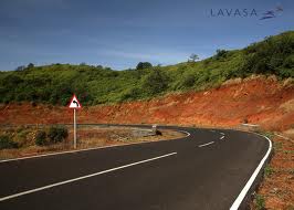
Lavasa is the first planned Hill Cities in India

0 comments
Lavasa is the first planned Hill Cities in India, Lavasa is located in the western mountain ranges of India, the area is located behind the 20 kms long Dam/ Lake of Varasgaon and it is quite close to the major cities of Pune and Mumbai. Lavasa is just about 65 Kms (an hrs drive) from Pune and abut 200 Kms ( 3.5 hrs) from Mumbai.

Lavasa is surround by the mountains region and valleys,it is most popular for it's location and place,here people found many opportunities like mountain climbing, hiking and trekking. The popular attractions here include the Lake shore, which offers opportunities of adventure sports like boating against the strong currents of the lake, cruises and jet skiing. Lavasa also balanced life in harmony with nature and an inspirational destination for lifestyle seekers.

Lavasa is set on the seven hills of Maharashtra in the Mose valley. The city was planned and built as per the principles of ecological sustainable environment and urbanization. The city is equipped with all the latest means of technologies and facilities, the Master Plan of Lavasa has been developed by internationally renowned design consultant HOK, USA which are being managed by HCC India.

Lavasa is a hub for world-class educational institutions, hospitality and training centers, it's an arena for the mind where learning is a way of life.

The weather conditions in Lavasa remain throughout the year. The best time to visit Lavasa is during the monsoon season because of the pleasant weather that allows the exploration of natural wildlife and waterfalls located in the region.

Lavasa offers a refreshing and pleasant climate remain throughout the year with vast open spaces provides innumerable recreation and leisure activities like golf, trekking, rappelling to satiate the adventurer in you.

Lavasa is at its magical best during the monsoon season. The rains arrive, bringing with them the promise of months filled with pattering showers, lush green hills with many waterfalls playfully tumbling down them, and days are spent looking out at the rain through a wet window, smiling at a paradise that has been found. After the showers pass, the entire countryside is alive with freshness.

Lavasa can be reached from Pune, which has the nearest airport at a distance of 49 kilometres from Lavasa. The airport of Pune is connected to nine other Indian cities. The other airports located nearby are Chhtarapati Shivaji International Airport (CSIA) of Mumbai, located around 215 kilometres. The recently constructed airport at Panvel is located 145 kilometers away.

Monday, May 2, 2011

Nainital the lake city

2 comments

Nainital is a town in the Indian state of Uttarakhand and headquarters of Nainital district in the Kumaon foothills of the outer Himalayas. Nainital is a precious jewel in the Himalyan necklace. Nainital also known as the lake city and lake district of Uttarankahd, it is located around the Naini Lake. This place is named after the Goddess Naini Devi, the presiding idol of the area. Nainital is a popular summer retreat of India, Nainital attracts so many tourists during the summer heat. There are few other lakes around Nainital which are equally beautiful and attractive as the Naini lake.River Ramganga originates from the Doodha Tauli ranges in district Pauri Garhwal. It enters into district Nainital, before re-entering into district Pauri Garhwal. It is renowned for its lake, bird's-eye views, and prestigious educational institutions.
Nainital is located in the Kumaon hills and the weather is very pleasant throughout the year except during winter months. The temperature is not very high at any time but in winters it becomes very cold. The climate of Nainital is regulated by the lake here which showers rain almost every afternoon. The best time visit the place is between April to June and then again in September October. The months of January to March are marked by the snowfall which is for a very short time.Some of the important places in the district are Nainital, Haldwani, Kaladhungi, Ramnagar, Bhowali, Ramgarh, Mukteshwar, Bhimtal, Sattal and Naukuchiatal. Nainital’s unending expense of scenic beauty is nothing short of a romance with awe-inspiring and pristine Mother nature.

Tuesday, March 1, 2011

Kedarnath

0 comments
Kedarnath is one of the Char(4) Dham a very holy pilgrimage destination for all Hindus at Uttarakhand in India. Kedarnath range stands one of the famed Jyotilirlingam of Lord Shiva. Lying at an altitude of 3.581 mts. above the sea level. It is the remotest of all the chardham sites surrounded by some of the most beautiful snow capped mountains. The present temple was built back in the 8th century AD by Adi Shankaracharya is next to the site of an earlier temple that legend says was built by the Pandavas of the Mahabharata. The samadhi (final resting place) of Adi Shankaracharya is located behind the main shrine. The temple is made out of gigantic, evenly cut grey slabs of stone, and the inner walls of the assembly hall are decorated with figures of several deities and mythological scenes. Just outside the temple stands a large statue of Nandi Bull as a guard. Kedarnath Temple is believed to be more than 1000 years old.

Many other place are also very beautiful to viewers from kedarnath like Chorabari (Gandhi Sarover), Vasuki Tal, Gaurikund , Triyuginarayan, Deoria Tal etc.

Chorabari (Gandhi Sarover)

According to Hindu Legends, Gandhi Sarovar is a small lake from where Yudhishthir, you take enjoy camping at himalaya hills the eldest of the Pandavas is believed to have moved to heaven. The floating ice on the sparkling waters is an amazing sight that attracts tourists from all over the country and abroad.


Vasuki Tal
Located about 4135 meters above sea level and surrounded by lofty mountains, Vasuki Tal is a picturesque lake which offers a commanding view of the Chaukumbha peaks.


Gaurikund
To reach Kedarnath, Gaurikund is the main trekking base. From Gaurikund, there is a 14 kms long stretch after which the pilgrims reach Kedarnath.


Triyuginarayan Temple Triyuginarayan
Triyuginarayan, 5 kms trek from Sonprayag is the mythological place of marriage of Lord Shiva and Goddess Parvati. It is believed that an eternal flame which is said to have been a proof to their marriage burns in front of the temple even today.


Deoria Tal

Sari Village on the Chopta-Ukhimath road is the last bus terminus from where a 2 km trek leads to Deoria lake. Situated at an altitude of 2348 meters, this beautiful lake gives the spectacular reflection of the snow capped mountains in the lake water. If you are a nature lover then this is the right choice.


Kedarnath is approachable on foot from Gaurikund, which is directly  connected by road to Rishikesh, Kotdwar, Dehradun, Haridwar and other important hill stations of Garhwal and Kumaon region. The closest rail connection is at Rishikesh (234 km from Kedarnath and at Kotdwar (260 km from Kedarnath). he closest airport is the Jolly Grant in Dehradun (251 km from Kedarnath). The best time to visit Kedarnath is between May-October as during the winter season it gets closed.Many ashrams and dharamshalas provide cheap accommodation. There are also many private hotels and restaurants although most have only basic facilities. Also beware that Kedarnath can be extremely crowded during peak pilgrim season. The state-run guest house is generally booked throughout, so arrive early if you want options.

Thursday, January 6, 2011

Leh Ladakh

0 comments
In case you are planning to go to Ladakh on a vacation, you must be looking for some travel tips such as weather conditions of Leh Ladakh, the best time to go there, how to reach. We trying to provide some information related to Ladakh . Ladakh is the mountainous region of Jammu and Kashmir. Bounded by two of the world's mightiest mountain ranges, the Great Himalaya and the Karakorum, the area known as the Trans-Himalaya. The settled population live between 2700 m and 4500 m. it's the largest and the least populated region of Jammu and Kashmir.Temperatures in Ladakh, range from-3 to 30 degrees Celsius in the summer and from -20 to 15 degrees Celsius in the winter.The people are a mixture of Buddhist and Muslim.Buddhists are the majority in the east close to the Chinese border and a slight majority overall while Muslims have the majority in the north and west . Ladakh is a region in India totally isolated from the modern world. Ladakh means "land of high passes". Until the coming of the aircraft, the only access into this remote, high Trans-Himalayan kingdom was across several high pass crossings. From the west the Zoji La at 14,000 feet is the lowest. Taglang La to the southeast is17,200 feet high and a military highway now crosses this coming from Manali. To the north is the Khardung La - at 18,200 feet, the only access into the Nubra valley and the Karakorams. Dead ends now,
but important in centuries past, were the northern passes on the Central Asian trade route - Saser La and the Karakorum pass.From November to May, Ladakh is almost completely cut off from the outside world.Even in summer, getting here involves crossing the highest mountain passes in the world, or a hair-raising flight that weaves between the peaks.Tourism and hydro-electric power are flooding the region with money, and global warming is altering rainfall patterns, threatening farming cycles and Ladakh’s traditional mud-brick architecture.You need to be physically fit to undertake a tour to Leh Ladakh. It is advisableto take at least 12-24 hours of rest after reaching Leh to fully acclimatize to the high altitude. If you feel shortness of breath, nausea, dizziness, or fatigue, immediately take some rest. Always carry drinking water,chocolates or energy bars while traveling.Medicines, moisturizers and sun-screen lotion are a must when traveling to Leh Ladakh. Since Ladakh is on India's sensitive north western border, the movement of foreign tourists is restricted in some areas of Ladakh. Foreign tourists may not travel beyond one mile north of the Zoji-la-Dras-Bodhkarbu- Khalatse road, except to visit the monasteries of Tia-Tingmosgang, Rizong, Likir and Phyang. Shey, Thikse, Chemrey and Tak-thok monasteries lying north of the Leh-Upshi road can also be visited. The Leh-Manali road is also only open upto one mile east of its general alignment. Foreign
tourists can visit some newly opened areas in north eastern and northern regions of Ladakh, but only with permission of the Deputy Commissioner Leh.In present times, the only two land routes to Ladakh in use are from
Srinagar and Manali. Travelers from Srinagar start their journey from Sonamarg, over the Zoji la pass (3,450 m, 11,320 ft) via Dras and Kargil (2,750 m, 9,022 ft) passing through Namika la (3,700 m, 12,140 ft) and Fatu la(4,100 m, 13,450 ft.) This has been the main traditional gateway to Ladakh since historical times. However, with the rise of militancy in Kashmir, the main corridor to the area has shifted from the Srinagar-Kargil-Leh routevia Zoji la to the high altitude Manali-Leh Highway from Himachal Pradesh. The highway crosses four passes, Rohtang la (3,978 m, 13,050 ft), Baralacha la (4,892 m, 16,050 ft), Lungalacha la (5,059 m, 16,600 ft) and Taglang la(5,325 m, 17,470 ft), and is open only between July and mid-October when snow is cleared from the road. There is one airport in Leh, from which there are multiple daily flights to Delhi on Jet Airways, Air Deccan, and Indianand weekly flights to Srinagar and Jammu. Buses run from Leh to the surrounding villages. There is about 1,800 km (1,100 mi) of roads in Ladakh of which 800 km (500 mi) is surfaced. The Manali-Leh-Srinagar road makes upabout half of the road network, the remainder being spurs off it. Ladakh is criss-crossed by a complex network of mountain trails which, even today provides the only link to most of the valleys, villages and high pastures.For the traveler with a number of months it is possible to trek from one end of Ladakh to the other, or even from places in Himachal Pradesh. The large number of trails and the limited number of roads allows one to stringtogether routes that have road access often enough to restock supplies, but avoid walking on motor roads almost entirely.

Vietnam vacation with Vietnam Vision Travel - Vietnam Tour Operator offers private vacations, customize tour, adventure tours, excursion, special packages, beach holidays, family packages, cycling tour program in Vietnam.